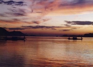
While most Indian and Bangladeshi rivers bear female names, this river has a rare male name, as it means “son of Brahma” in Sanskrit.
The Brahmaputra is navigable for most of its length. The lower reaches are sacred to Hindus. The river is prone to catastrophic flooding in spring when the Himalayan snows melt. It is also one of the few rivers in the world that exhibit a tidal bore.
Brahmaputra in Tibet
The river Yarlung Tsangpo originates in the Jima Yangzong glacier near Mount Kailash in the northern Himalayas. It then flows east for about 1700 km, at an average height of 4000 m, and is thus the highest of the major rivers in the world. At its easternmost point, it bends around Mt. Namcha Barwa, and forms the Yarlung Tsangpo Canyon which is considered the deepest in the world.
Brahmaputra in India
As the river enters Arunachal Pradesh, it is called Siang and makes a very rapid descend from its original height in Tibet, and finally appears in the plains, where it is called Dihang. It flows for about 35 km and is joined by two other major rivers: Dibang and Lohit. From this point of confluence, the river becomes very wide and is called Brahmaputra. It is joined in Sonitpur District by the Jia Bhoreli (named the Kameng River where it flows from Arunachal Pradesh) and flows through the entire stretch of Assam. In Assam the river is sometimes as wide as 10 km. Between Dibrugarh and Lakhimpur districts the river divides into two channels—the northern Kherkutia channel and the southern Brahmaputra channel. The two channels join again about 100 km downstream forming the Majuli island. At Guwahati near the ancient pilgrimage centre of Hajo, the Brahmaputra cuts through the rocks of the Shillong Plateau, and is at its narrowest at 1 km bank-to-bank. Because the Brahmaputra is the narrowest at this point the Battle of Saraighat was fought here. The first rail-cum-road bridge across the Brahmaputra was opened to traffic in April 1962 at Saraighat.
The old Sanskrit name for the river is Lauhitya and the local name in Assam is Luit. The native inhabitants, i.e., the Bodos called the river Bhullam-buthur, which means ‘making a gurgling sound’, later Sanskritized into Brahmaputra.
When compared to the other major rivers in India, the Brahmaputra is less polluted but it has its own problems: petroleum refining units contribute most of the industrial pollution load into the basin along with other medium and small industries. The main problem facing the river basin is that of constant flooding. Floods have been occurring more often in recent years with deforestation, and other human activities being the major causes.
Brahmaputra in Bangladesh
In Bangladesh, the Brahmaputra splits into two branches: the much larger branch continues due south as the Jamuna (Jomuna) and flows into the Lower Ganges, locally called Padma (Pôdda), while the older branch curves southeast as the lower Brahmaputra (Bromhoputro) and flows into the Meghna. Both paths eventually reconverge near Chandpur in Bangladesh and flow out into the Bay of Bengal. However, the actual Brahmaputra river in Bangladesh passes through the Jamalpur and Mymensingh district. Fed by the waters of the Ganges and Brahmaputra, this river system forms the Ganges Delta, the largest river delta in the world. Source: Wiki

Pingback: Brahmaputra river from Space | Assam Information Portal
Pingback: Mysterious fish deaths in Brahmaputra | Assam Information Portal